TS

Topographic surveys in Moscow and Moscow Region

We will survey the site and everything on and beneath it: relief, buildings, roads and underground utilities. We will prepare the technical report, agree utilities with operators and pass expert review.

  • we operate since 2013
  • none a negative expert review conclusion

Registration in Moscow GISOGD and Moscow Region GISOGD — handled in-house

145,0144,0book 2access road, asphaltV1 Ø150G Ø5710 kV cableK1 Ø200pt 1pt 2144,62144,48145,10145,21144,87144,35144,21145,06143,94Scale 1:500
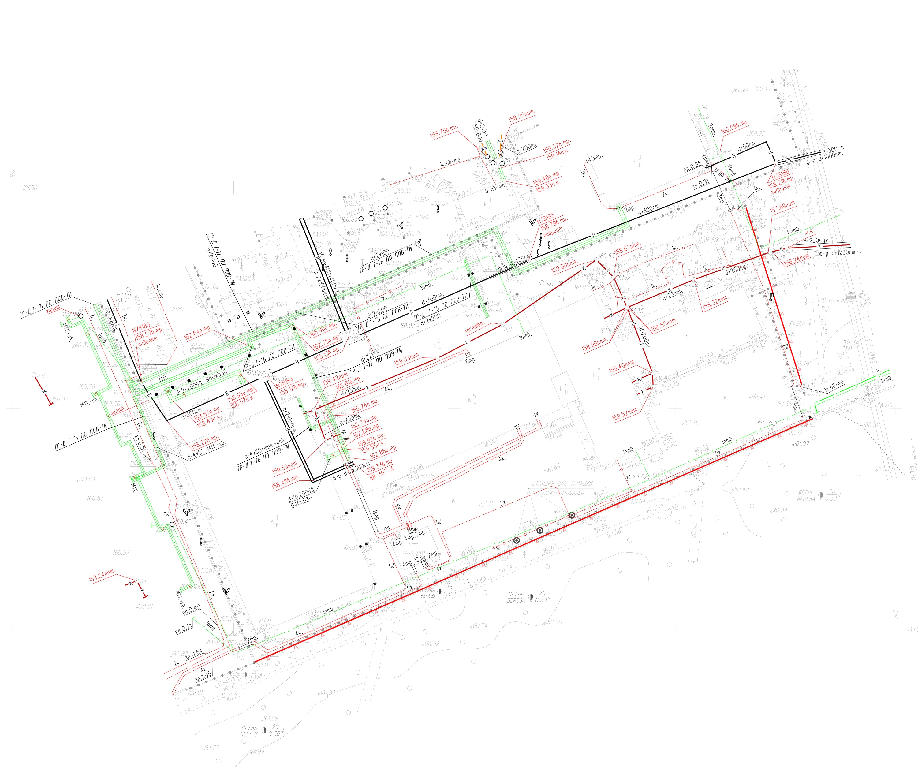
1:500 engineering topographic planHover over a layer— we will show what can be seen on the topographic plan

What topographic surveys are

Topographic surveys — is a site survey and collection of data on terrain, existing development and underground utilities. The main deliverable is an engineering topographic plan (often referred to in Moscow practice as a geobasis / geopodoshva): a precise 1:500 drawing of the site showing ground elevations at every point, the locations of buildings, trees and roads, and underground pipes and cables.

Based on the topographic plan, the architect positions the building, the site planner determines design elevations and establishes the site grading, and MEP engineers design the utility connections. It is also used to plot the locations of geotechnical boreholes. For design and expert review purposes, we conduct topographic surveys and compile a technical report. The scope of work is defined by the client's brief and project requirements.

Interesting factSurveying

A country connected by measured triangles

Before satellite methods became widespread, triangulation networks connected vast areas. Surveyors measured angles between neighbouring stations, using towers and pyramids to see above forests. The number of observed neighbours depended on the network layout.

Source: USSR mapping agency · topographic survey manual

A line on a plate defines the height datum

Normal heights in Russia’s Baltic height system are referenced to the zero of the Kronstadt tide gauge: a horizontal line on a copper plate in a bridge abutment. The national levelling network connects heights to this datum.

Source: Russian Government Decree No. 1240

Three coordinates need four satellites

In standard positioning, a receiver uses signals from at least four satellites to determine its three coordinates. The extra unknown is the receiver’s clock error, which must be calculated along with its position.

Source: NOAA

Survey stations became World Heritage

The Struve Geodetic Arc is a survey chain about 2,820 kilometres long, established in the 19th century to refine measurements of Earth’s size and shape. It now spans ten countries; 34 of its stations are listed by UNESCO.

Source: UNESCO

What deliverable you need

For design and expert review, we carry out topographic surveys and prepare a technical report. A topographic site plan can also be ordered separately.

Key informationDesign documentation under Russian Government Decree No. 87, expert review, building permitTopographic surveys for designFor buildings and structures subject to expert review and a building permit.
  • 1:500 engineering topographic plan
  • Survey and statutory sign-off of underground utilities with network operators
  • In Moscow — utility verification with GBU Mosgorgeotrest
  • Technical report in accordance with SP 47.13330 and SP 317.1325800
  • Registration in Moscow GISOGD or Moscow Region GISOGD
  • Expert review support

from 120,000 ₽

Private house, plot exempt from expert review and building permitTopographic plan of the plotWhen expert review is not required: private house design, building siting, landscaping, or pre-purchase site assessment.
  • 1:500 topographic plan showing relief and site features
  • Visible utilities — from manholes and poles
  • Plan in DWG and PDF
  • Without a formal technical report — faster and cheaper

from 30,000 ₽

Scope and stages of topographic surveys

See a real example — a reconstruction survey report of a non-residential building on Narvskaya Street in Moscow: 1:500 topographic survey of 2.5 ha with underground utility verification against the Consolidated Utility Plan.

11–2 days

Baseline data and programme of works

1–2 days

We review the technical brief, plot boundaries according to the EGRN extract, and the site location plan. We request records of geodetic control points, previous surveys and underground utilities: in Moscow from GBU Mosgorgeotrest, and in the Moscow Region from the Moscow Region GISOGD, archives and utility owners.

Based on these data, we draw up the programme of works: survey area and scale, coordinate system, working methods and report structure.

Stage outcome: a clear scope, timeline and deliverables before we even mobilise.

What we request before the site visit
baseline data for the survey programme
  • EGRN (Unified State Register of Real Estate) extract and plot boundaries
  • Geodetic network monument data
  • Previous site surveys
  • Consolidated Underground Utilities Plan (Moscow)
  • Permit or entry pass if the site has restricted access
TS-D
21 day

Horizontal and vertical control network

1 day

We establish temporary survey stations on site and determine their coordinates using GNSS receivers linked to a reference station network. In Moscow, surveys are conducted in the local city coordinate and height datum; in the Moscow Region, in MSK-50 and the Baltic Height System.

The entire plot is then surveyed from these control points — so the accuracy of the control network determines the accuracy of the entire plan.

Stage outcome: control points with coordinates in the local Moscow or Moscow Region system, tied to the state geodetic network.

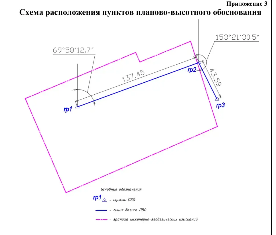
Horizontal and vertical control network diagram
temporary survey markers
Layout of horizontal and vertical control points on the site
sheet 54
3from 1 day

1:500 topographic survey

from 1 day

Land surveyors map the plot using an electronic total station and GNSS receiver: relief, buildings, access roads, fencing, poles, manholes and trees. A single hectare comprises several hundred survey points (spot levels).

We trace underground utilities using a cable and pipe locator, open manholes, and record pipe diameters, materials and depths. Everything not visible from the surface is cross-checked against utility owners' records.

Stage outcome: field measurements and field sketches for every feature on the plot.

Scope of work at Narvskaya
from technical report 36-23-TS
Survey area2.5 ha
Scale and contour interval1:500, 0.5 m
Grounds for justificationby satellite method
Underground utility survey2.5 ha
Coordinate systemMoskovskaya
Manholes inspectedwater supply, foul drainage, district heating, telecommunications
36-23-TS-T
43–5 days

Preparation of a 1:500 engineering topographic plan

3–5 days

We adjust the measurements, build a digital terrain model and draft a 1:500 scale plan with 0.5 m contour intervals. We plot all utilities with labels and show urban planning regulation lines and plot boundaries on the plan.

We deliver the plan in DWG and PDF formats — ready for the designer to use immediately.

Stage outcome: 1:500 engineering topographic plan in DWG and PDF.

Engineering topographic plan
Scale 1:500, Narvskaya — hover to zoom
Excerpt from the 1:500 engineering topographic plan showing underground utilities and urban planning regulation lines
36-23-TS-G
5from 14 days in Moscow, from 30 in Moscow Region

Agreeing underground utility records with operators

from 14 days in Moscow, from 30 in Moscow Region

For design and expert review, plotting utilities from visible manhole covers is not enough: the completeness and accuracy of plotted services must be confirmed by their owners. In Moscow, the plan is verified against the Consolidated Plan of Underground Utilities at Mosgorgeotrest; in the Moscow Region, we obtain sign-offs from the water utility, gas utility, power grid companies and telecoms operators.

In Moscow, verification with Mosgorgeotrest takes from 14 days; in the Moscow Region, approvals from utility owners typically take from 30 days. We obtain all approvals ourselves — the client does not need to visit utility operators.

Stage outcome: a plan with verified utility completeness — ready for designing utility connections.

Who confirms the utilities
plan approval with utility owners
  • Water utility — water supply and foul drainage
  • Gas utility — gas pipelines
  • Power networks — cables and overhead power lines
  • District heating
  • Telecom operators
  • Moscow — verification against the Consolidated Plan of GBU Mosgorgeotrest
TS-S
63–5 days

Technical report and registration in GISOGD

3–5 days

We compile the technical report: methodology, accuracy, coordinate catalogues, control network diagrams and the plan. We register the report in the state information system: in Moscow — in the city's GISOGD; in the region — in the GISOGD of the Moscow Region, archives and with utility owners.

Without official registration, the report will not be accepted for expert review.

Stage outcome: registered technical report for design and expert review.

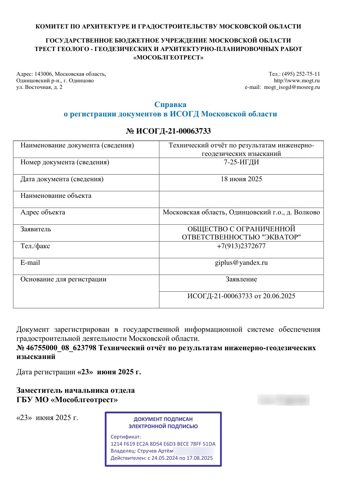
Registration in ISOGD
report registration certificate
Certificate of registration of the topographic survey technical report in the Information System for Urban Development (ISOGD)
7-25-TS
7total from 4 weeks in Moscow, from 6 in the Region

Technical report on topographic surveys

total from 4 weeks in Moscow, from 6 in the Region

The report is the primary deliverable of the surveys: it forms the basis for design and is checked during expert review. Browse our report for a non-residential building on Narvskaya Street in Moscow. It includes:

  • Text section — site conditions, methodology, measurement accuracy, information on utilities and their owners
  • Appendices — technical brief and programme of works, network adjustment and coordinate catalogues
  • Graphical part — control network diagrams and 1:500 engineering topographic plan showing underground utilities

Survey deliverables: technical report and plan in electronic format, registered in the Moscow GISOGD or Moscow Region GISOGD.

55 sheets of this report. Client details, signatures and stamps have been redacted.

Technical report 36-23-TS · non-residential building on Narvskaya St — original report in RussianSheet 1 of 55
Technical report 36-23-TS · non-residential building on Narvskaya St, sheet 1
Sheet 1
Technical report 36-23-TS · non-residential building on Narvskaya St, sheet 2
Sheet 2
Technical report 36-23-TS · non-residential building on Narvskaya St, sheet 3
Sheet 3
Technical report 36-23-TS · non-residential building on Narvskaya St, sheet 4
Sheet 4
Technical report 36-23-TS · non-residential building on Narvskaya St, sheet 5
Sheet 5
Technical report 36-23-TS · non-residential building on Narvskaya St, sheet 6
Sheet 6
Technical report 36-23-TS · non-residential building on Narvskaya St, sheet 7
Sheet 7
Technical report 36-23-TS · non-residential building on Narvskaya St, sheet 8
Sheet 8
Technical report 36-23-TS · non-residential building on Narvskaya St, sheet 9
Sheet 9
Technical report 36-23-TS · non-residential building on Narvskaya St, sheet 10
Sheet 10
Technical report 36-23-TS · non-residential building on Narvskaya St, sheet 11
Sheet 11
Technical report 36-23-TS · non-residential building on Narvskaya St, sheet 12
Sheet 12
Technical report 36-23-TS · non-residential building on Narvskaya St, sheet 13
Sheet 13
Technical report 36-23-TS · non-residential building on Narvskaya St, sheet 14
Sheet 14
Technical report 36-23-TS · non-residential building on Narvskaya St, sheet 15
Sheet 15
Technical report 36-23-TS · non-residential building on Narvskaya St, sheet 16
Sheet 16
Technical report 36-23-TS · non-residential building on Narvskaya St, sheet 17
Sheet 17
Technical report 36-23-TS · non-residential building on Narvskaya St, sheet 18
Sheet 18
Technical report 36-23-TS · non-residential building on Narvskaya St, sheet 19
Sheet 19
Technical report 36-23-TS · non-residential building on Narvskaya St, sheet 20
Sheet 20
Technical report 36-23-TS · non-residential building on Narvskaya St, sheet 21
Sheet 21
Technical report 36-23-TS · non-residential building on Narvskaya St, sheet 22
Sheet 22
Technical report 36-23-TS · non-residential building on Narvskaya St, sheet 23
Sheet 23
Technical report 36-23-TS · non-residential building on Narvskaya St, sheet 24
Sheet 24
Technical report 36-23-TS · non-residential building on Narvskaya St, sheet 25
Sheet 25
Technical report 36-23-TS · non-residential building on Narvskaya St, sheet 26
Sheet 26
Technical report 36-23-TS · non-residential building on Narvskaya St, sheet 27
Sheet 27
Technical report 36-23-TS · non-residential building on Narvskaya St, sheet 28
Sheet 28
Technical report 36-23-TS · non-residential building on Narvskaya St, sheet 29
Sheet 29
Technical report 36-23-TS · non-residential building on Narvskaya St, sheet 30
Sheet 30
Technical report 36-23-TS · non-residential building on Narvskaya St, sheet 31
Sheet 31
Technical report 36-23-TS · non-residential building on Narvskaya St, sheet 32
Sheet 32
Technical report 36-23-TS · non-residential building on Narvskaya St, sheet 33
Sheet 33
Technical report 36-23-TS · non-residential building on Narvskaya St, sheet 34
Sheet 34
Technical report 36-23-TS · non-residential building on Narvskaya St, sheet 35
Sheet 35
Technical report 36-23-TS · non-residential building on Narvskaya St, sheet 36
Sheet 36
Technical report 36-23-TS · non-residential building on Narvskaya St, sheet 37
Sheet 37
Technical report 36-23-TS · non-residential building on Narvskaya St, sheet 38
Sheet 38
Technical report 36-23-TS · non-residential building on Narvskaya St, sheet 39
Sheet 39
Technical report 36-23-TS · non-residential building on Narvskaya St, sheet 40
Sheet 40
Technical report 36-23-TS · non-residential building on Narvskaya St, sheet 45
Sheet 45
Technical report 36-23-TS · non-residential building on Narvskaya St, sheet 46
Sheet 46
Technical report 36-23-TS · non-residential building on Narvskaya St, sheet 47
Sheet 47
Technical report 36-23-TS · non-residential building on Narvskaya St, sheet 48
Sheet 48
Technical report 36-23-TS · non-residential building on Narvskaya St, sheet 49
Sheet 49
Technical report 36-23-TS · non-residential building on Narvskaya St, sheet 50
Sheet 50
Technical report 36-23-TS · non-residential building on Narvskaya St, sheet 51
Sheet 51
Technical report 36-23-TS · non-residential building on Narvskaya St, sheet 52
Sheet 52
Technical report 36-23-TS · non-residential building on Narvskaya St, sheet 53
Sheet 53
Technical report 36-23-TS · non-residential building on Narvskaya St, sheet 54
Sheet 54
Technical report 36-23-TS · non-residential building on Narvskaya St, sheet 55
Sheet 55
8until the report is issued

Expert review support

until the report is issued

If the expert reviewer raises questions about the topographic survey, forward them to us — we will respond and revise the report if necessary.

Positive conclusion
  • You submit the report for expert review and forward any comments to us
  • We contact the expert reviewer directly and resolve all queries
  • We support the report through to a positive expert review conclusion
  • Not a single negative expert review conclusion in 13 years

Our projects and prices for topographic surveys

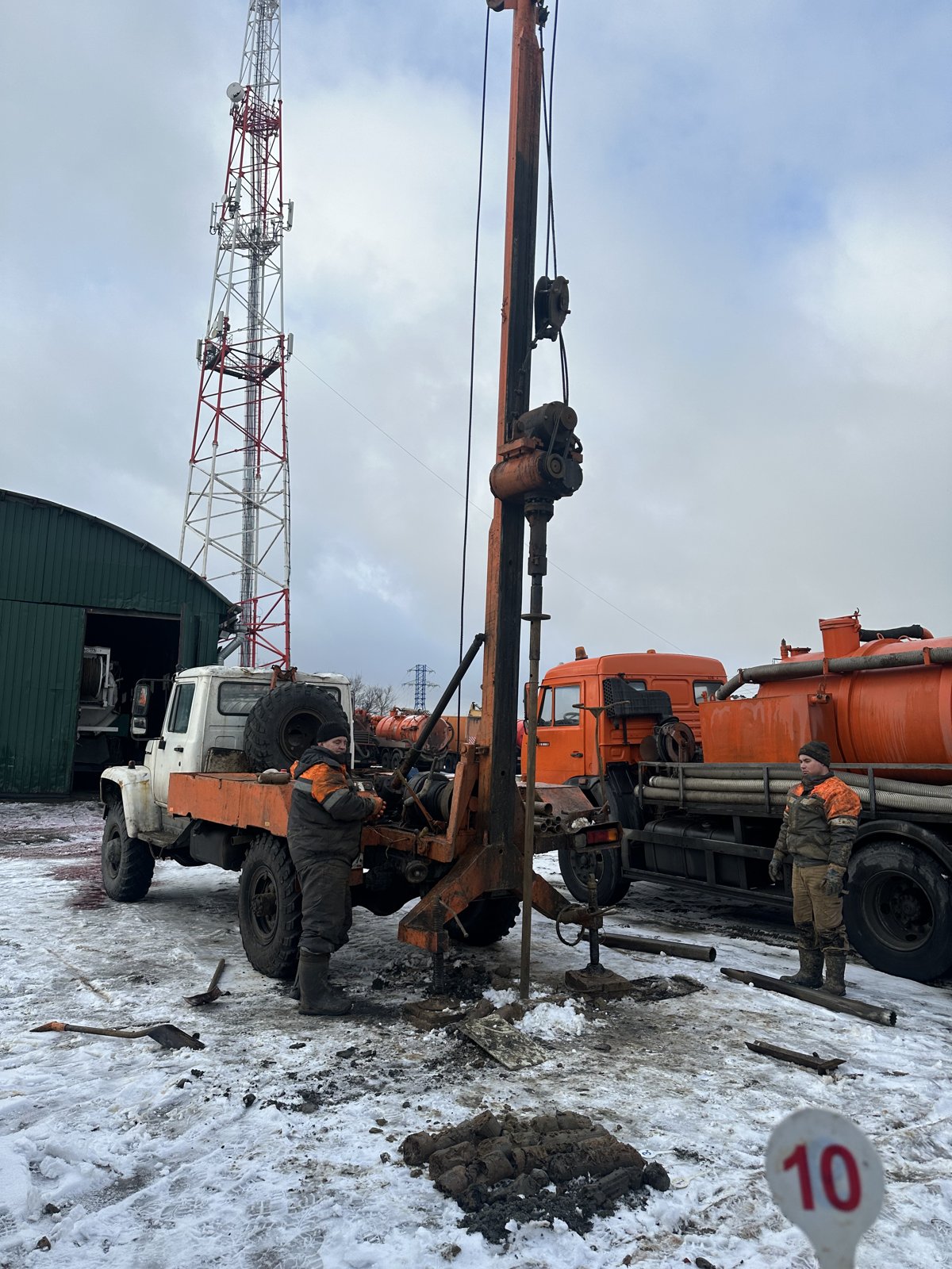
Contract prices for topographic surveys on completed projects. Projects with photos feature a detailed breakdown of the work on a dedicated page.

These are just some of our projects — we carry out work on 40–50 sites every year.

Calculate the approximate cost of a topographic survey for your plot

Enter the survey parameters — the calculator will show an indicative the cost according to our rates. We will confirm the final price in our quotation once we have reviewed the site boundaries and technical brief.

Indicative cost—
  • Area—
  • Site area—
  • Duration—
  • Result—
Based on your inputs, without registration or submitting an enquiry.

Send your technical brief for an exact quote
  • What determines the price
  • Survey areamain scope of work — hectares
  • Development densitydense urban development takes longer to survey than a vacant plot
  • Underground utility networkshow many utilities there are and how many utility owners must approve the plan
  • Moscow or Moscow Regionverification at Mosgorgeotrest, excavation permit, entry passes
  • Deliverablesfull report and registration, or topographic plan only
  • Urgencyweekend working and parallel field crews

Questions about topographic surveys

How does a land survey differ from topographic surveys for construction?

A topographic survey provides the site plan itself. Topographic surveys as an engineering discipline comprise the plan plus utility approvals from underground network owners, a technical report and registration in the state information system. A project subject to expert review requires full topographic surveys; for a private house or landscaping, a topographic plan is usually sufficient.

Are a geodetic base map (geopodosnova) and an engineering topographic plan the same thing?

In Moscow practice, a 1:500 engineering topographic plan for design is commonly called a 'geopodosnova' (topographic base plan). We carry out the survey, agree utility records with asset owners and register the plan in the GISOGD of Moscow or the Moscow Region.

What topographic survey scale is needed for design?

For building and site design — 1:500 with 0.5 m contour intervals. This is the standard for expert review. For large sites and linear routes, 1:1000 or 1:2000 is sometimes used — the scale is specified in the technical brief.

Why get a topographic survey approved by utility operators?

To ensure the design does not clash with live pipes and cables. Utility owners confirm that all their services are plotted on the plan and plotted accurately. Without this, the plan will not be accepted for utility design or expert review.

What does registering a topographic plan in GISOGD mean?

This is the submission of survey results to the State Information System for Urban Development (GISOGD) — the city GISOGD in Moscow, and the regional GISOGD MO in the Moscow Region. Once registered, the report can be used for expert review and for obtaining an excavation permit.

Can topographic surveys be done in winter?

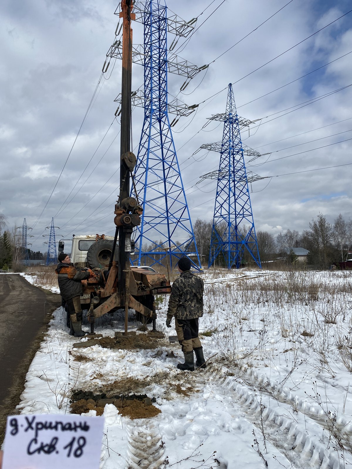
Yes, we work all year round. In deep snow, ground elevations are surveyed by probing down to the ground surface, and manholes are dug out.

What is needed for a cost estimate?

Cadastral number or survey boundary plan, purpose of works and technical brief, if available. If there is no technical brief, we will prepare it ourselves.

How long is a topographic plan valid?

Under SP 47.13330.2016 (Cl. 5.1.20), the validity period of an engineering topographic plan is generally no more than 2 years, subject to confirmation that the information shown remains current. If the terrain has changed, the plan is updated; if changes to features and relief exceed 35%, the survey is repeated from scratch. Plans surveyed with snow cover exceeding 20 cm must be updated during a favourable season. Send us your old plan — we will check whether it can be updated or if a new survey is required.

Send your site boundaries — we will prepare a quotation the same day

If you do not have a technical brief, describe the project: site location, planned construction, and whether a design exists. We will reply with a scope of work and cost.