Modular boiler house, Moskovsky (New Moscow)
Topographic, geotechnical, environmental and hydrometeorological surveys for the construction of a 1.0 MW modular hot-water boiler house with two chimneys at an operating industrial site.


Objective
We completed topographic, geotechnical, environmental and hydrometeorological surveys for the design of a 1.0 MW packaged modular hot-water boiler house (BMK) in the town of Moskovsky, Novomoskovsky Administrative Okrug. The client is a manufacturing enterprise; the works were carried out in June–July 2026 under two contracts covering four types of surveys.
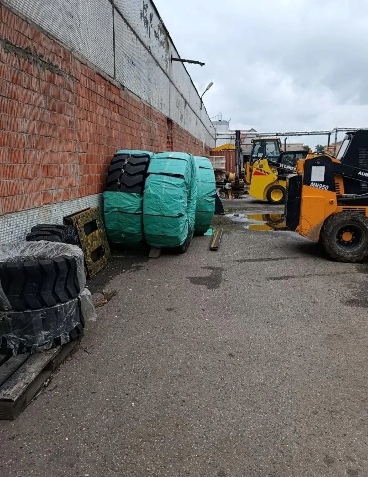
The 9.0 × 3.24 m boiler house, 4 m high, is founded on a raft foundation at a depth of 0.25 m, while two 12 m chimneys rest on a shared raft at a depth of 2 m. The site is a paved yard of an operating facility right next to an existing building wall, with live utilities and vehicle traffic, so work was carried out in restricted access conditions.
Two 12 m boreholes were drilled using a PBU-2 rig by cable-tool percussion drilling at 127 mm diameter with undisturbed block/tube sampling; the topographic survey was carried out by total station from Moscow geodetic control network stations with utility tracing, and the deliverables were uploaded to the Moscow GIS OGD via Mosgorgeotrest.

Scope of work and deliverables
GTGeotechnical surveys
Scope of work
- 2 boreholes 12 m deep — 24 linear metres of 127 mm cable-tool percussion drilling
- sampling of 10 undisturbed cohesive soil cores and 3 soil samples for corrosivity testing
- laboratory testing: physical properties on 10 samples, 6 direct shear tests and 6 oedometer consolidation tests, chemical analysis of aqueous extract
- site reconnaissance survey and collection of archival materials
Results
- Geotechnical conditions — complexity category II (medium); level site on a moraine plain with an elevation of 178.5 m.
- From the surface is 1.2–1.3 m of consolidated fill (clay loam with crushed stone and construction debris), underlain down to 12 m by uniform stiff fluvioglacial clay loam with fine sand interbeds (EGU-2, deformation modulus 23 MPa) — the bearing stratum for the raft foundations.
- There is no continuous aquifer down to 12 m; during heavy rain and snowmelt, perched groundwater may occur in the fill and sand interlayers.
- Made ground is not recommended as a foundation bearing stratum and requires replacement or ground improvement; the soils are non-aggressive to concrete and reinforcement, and moderately aggressive to carbon steel.
- Standard frost penetration depth is 1.03 m for loams and 1.29 m for fill; the soils are moderately frost-susceptible and karst sinkholes are ruled out.

- Embankment / Fill Made ground: brown stiff loam, reworked with sand, with inclusions of crushed stone and construction debris (tQIV)
- EGU-2 Greyish-brown sandy clay, stiff, with interbeds of fine sand, with inclusions of grus and gravel up to 10%, fluvioglacial and glaciolacustrine (f,lgQIIms)
- Groundwater level

Legend
- geotechnical borehole, number and depth, m
- geotechnical cross-section line, number
- footprints of the proposed boiler house and chimneys
TSTopographic surveys
Scope of work
- 1:500 engineering topographic plan for a 0.94 ha plot — industrial building, yard and open areas, contour interval — 0.5 m
- horizontal and vertical survey control network tied to Moscow geodetic control points, measurements with a Sokkia electronic total station
- survey and plotting of underground and above-ground utilities at the facility, statutory sign-off with utility operators
- registration of deliverables in the Moscow GIS OGD system (Mosgorgeotrest acceptance record)
Results
- The site is levelled, with elevations of 177.9–179.1 m; on-site plant utilities and municipal utilities running alongside the plot are plotted on the plan.
- The survey records were registered with Moscow GIS OGD on 09.07.2026.


ESEnvironmental surveys
Scope of work
- 1 soil sample for chemical contamination and 1 for agrochemical analysis, gamma survey of 0.1 ha
- gamma dose rate measurements at 10 points, noise, vibration and electromagnetic radiation measurements
- walkover survey, enquiries to regulatory authorities, schematic environmental status map and map of zones with special conditions for land use
Results
- Topsoil and subsoil fall into the 'permissible' contamination category (total pollution index Zc = 8.5), with petroleum hydrocarbons and benzo(a)pyrene within limits; the natural topsoil layer down to 1 m is suitable for landscaping use.
- Gamma background is 0.11–0.18 µSv/h against a reference level of 0.6; background air concentrations do not exceed 0.44 MAC (maximum allowable concentration).
- There are no specially protected natural areas, cultural heritage sites or sanitary protection zones of hazardous facilities within a 1 km radius.


HMHydrometeorological surveys
Scope of work
- site climatic summary based on weather station data: temperatures, precipitation including calculation of the 1% exceedance daily maximum, wind, snow cover
- characterisation of hazardous hydrometeorological phenomena in the area
- reconnaissance survey and assessment of the impact of the nearest watercourse, water protection zones
Results
- A climatic characterisation was prepared: mean annual temperature 5.1 °C, absolute minimum −44 °C, 1% exceedance probability daily maximum precipitation 92 mm, snow cover depth up to 58 cm.
- The site lies above the high-water level of the nearest stream and outside its water protection zone and riparian buffer strip.
Site photos
Result
The client received four technical reports for the boiler house design, and the topographic survey materials were registered in the Moscow GIS OGD. A positive non-state expert review conclusion was obtained.
This is just one of our projects: every year our specialists carry out surveys on 40–50 sites in Moscow, the Moscow Region, and across Russia.
Send your technical brief — we will price it the same day
If you do not have a technical brief, describe the project: site location, planned construction, and whether a design exists. We will reply with a scope of work and cost.