TOPOGRAPHIC PLAN · PRIVATE HOUSING

Topographic plan of a plot for a private house in Moscow and the Moscow Region

We will prepare an up-to-date 1:500 scale topographic plan of the plot for your architect, master planner, and landscape design. We survey the terrain, structures, and visible utilities before design work begins within 3 days.

  • 40 000 ₽
  • 3 days
  • Operating hours since 2013
  • 400+ projects across all disciplines
145,0144,0book 2access road, asphaltManholespt 1pt 2144,62144,48145,10145,21144,87144,35144,21145,06143,94Scale 1:500
Layer 1 · reliefRelief — 0.5 m contour intervalsContours and slopes show where the site is higher and lower. The designer uses them to calculate site grading, drainage and earthwork volumes.

Why your house design needs a topographic plan

Accurate plot data help you make informed decisions before construction begins.

  • House siting
    Allows you to account for elevation changes, set the finished floor level, and tie the house into the terrain.
  • Drainage and earthworks
    Helps accurately calculate excavation volumes, plan gradients, stormwater drainage, and a reliable land drainage system.
  • Landscaping
    Enables proper design of paths, entrance areas, terraces, retaining walls and landscaping features.

Interesting factTopographic surveys

The country was linked by measured triangles

Before satellite positioning became widespread, vast territories were linked by triangulation networks. Surveyors measured angles between neighbouring stations, building timber towers and pyramids to see above the forest canopy. The number of visible neighbouring stations depended on the network layout.


Source: GUGK USSR · Topographic Survey Instructions

The zero datum for elevations is a line on a plate

Normal heights in Russia's Baltic Elevation System are referenced to the zero mark of the Kronstadt tide gauge. This is a horizontal line on a copper plate set into a bridge abutment. Elevations across the country are tied to this datum through the national levelling network.

Source: Decree of the Government of the Russian Federation No. 1240

Three coordinates require four satellites

In standard mode, a satellite receiver determines three coordinates using signals from at least four satellites. The fourth unknown is the receiver's own clock error, which must be calculated alongside its position.

Source: NOAA

Geodetic control points have become World Heritage sites

The Struve Geodetic Arc is a chain of survey triangulations stretching some 2,820 kilometres, established in the 19th century to determine the exact size and shape of the Earth. Today it runs through ten countries, with 34 of its original station points inscribed on the UNESCO World Heritage List.

Source: UNESCO

How we prepare a topographic plan of a plot

From field measurements to DWG and PDF plan — 3 days.

1Day 1

Preparation and geodetic control

Day 1

We receive details about the plot, verify the cadastral number, and agree on a date for the surveyor's visit. We establish control points on site for accurate positioning of the plot within the coordinate system.

Stage outcome: Geodetic control network for the survey

Preparation and geodetic control
  • Obtaining the cadastral number or plot boundaries
  • Analysis of publicly available site data
  • Agreeing the fieldwork date and site access arrangements
  • Establishing survey control points
  • Tie-in to the state geodetic network
TOPOGRAPHIC PLAN
2Day 2

Detail and elevation survey

Day 2

We carry out instrumental measurements of all key features on the plot and along adjacent boundaries.

Stage outcome: Dataset of field measurements of the site

Detail and elevation survey
  • Survey of characteristic relief points and level changes
  • Measuring the outlines of buildings, fences, driveways and trees
  • Recording visible manholes, poles, and utility surface features
TOPOGRAPHIC PLAN
3Day 3

Drafting and handover of the plan

Day 3

We process the field data, compile a 1:500 digital drawing and deliver it to the client in convenient formats.

Stage outcome: Completed topographic plan in DWG and PDF

Drafting and handover of the plan
  • Office processing of field measurements
  • Drafting of the 1:500 scale topographic plan
  • Preparation of files in DWG and PDF formats
  • Delivery of completed materials to the client
TOPOGRAPHIC PLAN
✓Total: 3 days

What you receive upon completion

Total: 3 days

The final deliverables are fully ready to be handed over to your architect, master planner and landscape designer.

  • 1:500 scale topographic plan showing spot levels, buildings, fences, and access roads
  • Files in vector DWG format and easy-to-view PDF
  • Plotting of visible utility networks based on surveyed poles and manhole covers
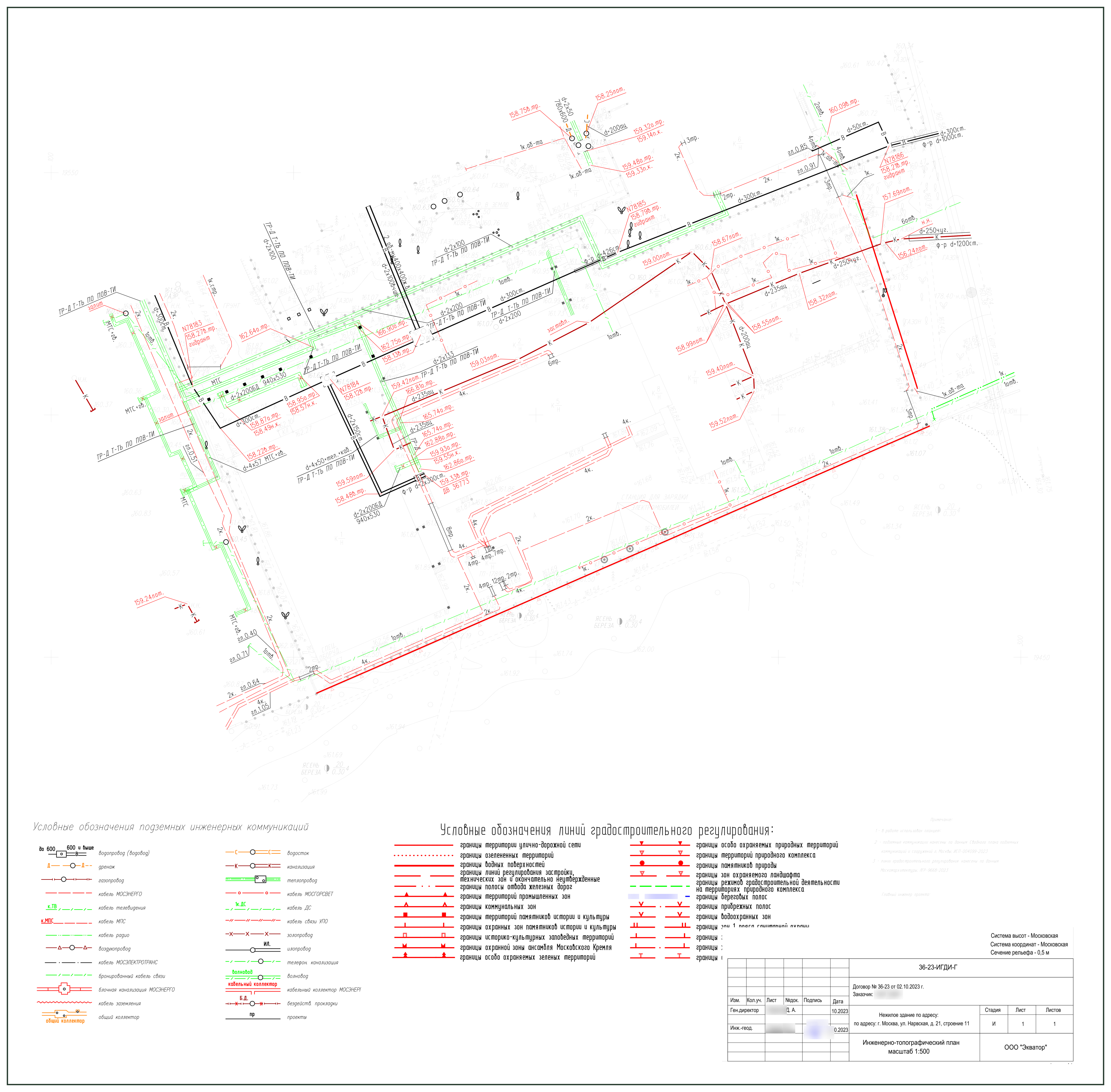
Sample topographic plan · Scale 1:500
Sample topographic plan with border and title block
36-23-TS-G
Topographic plan · sample — original report in RussianSheet 1 of 1
Full topographic plan with border and title block — sample
Sample layout of a topographic plan

Cost of a plot topographic plan

First plot — 40,000 roubles, each additional separate plot in a single order with a joint site visit — 30,000 roubles (2 plots — 70,000 roubles, 3 plots — 100,000 roubles).

First plot40 000 ₽1:500 topographic plan in DWG and PDF formats.
Each additional plot30 000 ₽Separate topographic plan for the next plot in the same order.

Order together with your neighbours: one shared site visit, with a separate topographic plan for each plot.

Cost of topographic plans in a single order
40 000 ₽per 1 plot
Plots in the order1
  • 2 plots70 000 ₽
  • 3 plots100 000 ₽
  • 4 plots130 000 ₽

Turnaround time — 3 days.

Order a topographic plan

Questions about topographic surveys of a plot

Why order a topographic plan before starting the design?

The plan provides accurate information on topography, structures, and access routes, helping to position the house properly and plan surface water drainage.

What is required to start work?

To start work, simply provide the plot's cadastral number or a diagram of its actual boundaries, and arrange site access for our land surveyors to take measurements.

How are utility networks shown on a topographic plan?

We plot visible utility elements based on manhole covers, chambers and poles. If necessary, tracing the exact route of buried underground services requires separate utility detection and sign-off from the operating utility companies.

Who can explain the final deliverable and answer questions?

EKVIZ specialists will thoroughly explain all symbols on the drawing and answer any questions from the client or their designers with no time limit after handover.

Order a topographic plan of your plot

Submit a request to get an accurate plot plan for house design and landscaping.