Agro-industrial complex, Khakassia
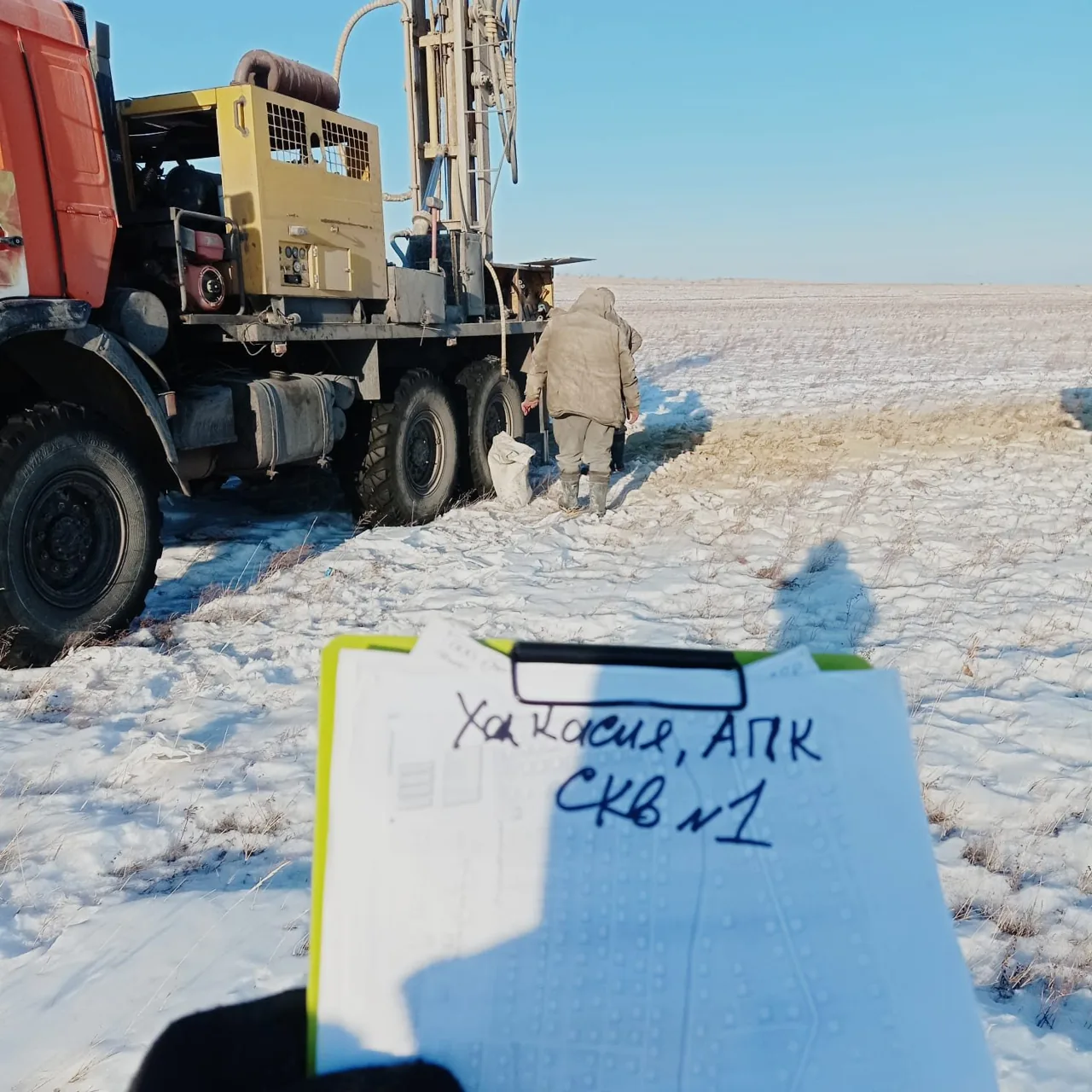
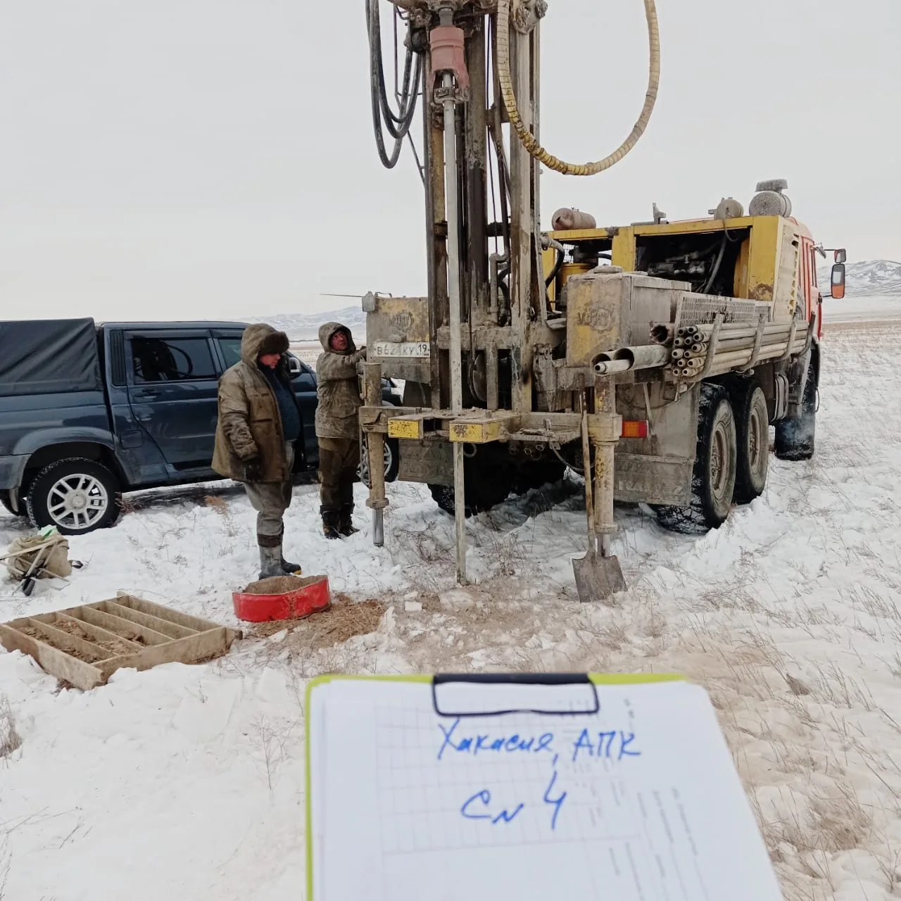
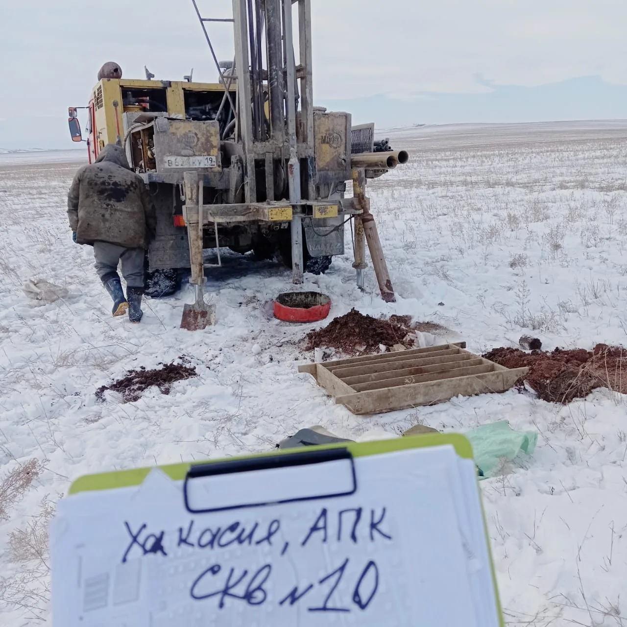
Geotechnical, environmental and hydrometeorological surveys for an agro-industrial complex with a slaughterhouse near the village of Zarechnaya in the Bogradsky District — our crew and drilling rig operated in the steppe in February.


Objective
We completed geotechnical, environmental and hydrometeorological surveys for the design of an agro-industrial complex on the northern edge of the Kosinsky Ridge in the Bogradsky District, Republic of Khakassia. The client is a design group of companies; the works took place in February–March 2024 under a single contract covering three types of surveys.
The complex comprises a slaughterhouse, an administrative and staff welfare building with a disinfection barrier, an industrial effluent treatment plant, and a storage tank with a pumping station; the site area is up to 4 ha and the building footprint up to 5,000 m². Building dimensions and foundation types were to be determined during design based on survey findings, so boreholes were spaced evenly across the site and the ground profile was investigated down to bedrock.
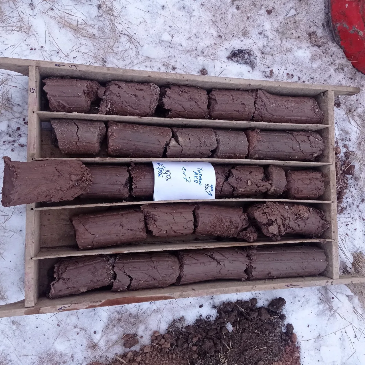
Ten boreholes were drilled by rotary core drilling at 160 mm diameter to depths from 4.4 to 15 m: sandstone underlies a thin layer of grus and clay, and drilling in rock was terminated after proving the top of unweathered sandstone. Site seismicity was refined by the seismic impedance method along three profiles. Environmental specialists collected 16 topsoil and soil samples, performed a gamma radiation survey and radon measurements, and hydrometeorologists prepared the climate summary.

Scope of work and deliverables
GTGeotechnical surveys
Scope of work
- 10 boreholes 4.4–15 m deep — 87.3 linear metres of 160 mm rotary core drilling to competent sandstone
- seismic microzonation using the seismic impedance method along 3 profiles with accelerogram calculation
- sampling of 20 disturbed coarse-grained soil samples, 10 rock specimens and 10 undisturbed cohesive soil cores, plus 3 samples for chemical analysis
- laboratory testing: physical properties, oedometer consolidation and direct shear, uniaxial compressive strength of rock, abrasiveness and weathering coefficients, soil corrosivity to concrete and metals
- reconnaissance survey of the 4 ha site, horizontal and vertical referencing of exploratory holes
Results
- Geotechnical conditions — complexity category II (medium); the site is located on a slope with elevations of 317.7–322.3 m; groundwater was not encountered down to a depth of 15 m.
- Beneath the topsoil lie proluvial–deluvial fine-gravel soil with a clay matrix (EGU-1, presumptive bearing resistance 450 kPa) and firm Paleogene clay (EGU-2, deformation modulus 19 MPa); below lie coarse-gravel angular soil (EGU-3, 500 kPa) and fractured medium-strength Upper Devonian sandstone (EGU-4, uniaxial compressive strength 28–35 MPa).
- Design seismicity of the site based on seismic microzonation is 6 degrees on the MSK-64 scale; design accelerograms have been generated.
- A perched man-made water table may form due to leaks and disrupted drainage — site grading, waterproofing and protection of substructure elements are recommended.
- Clayey soils in the frost zone are prone to frost heave when wetted; rock and coarse-grained soils provide a reliable foundation for all buildings in the complex.

- Topsoil Topsoil layer (solQIV)
- EGU-1 Light brown grus soil, low-strength, with pebbles and gravel up to 15%, clay matrix up to 40%, proluvial-deluvial (p,d)
- EGU-2 Reddish-brown firm lacustrine-alluvial clay, with interlayers of hard gravelly sandy loam at the top (l,aPgl-Eks)
- EGU-3 Light-grey angular gravel soil, low strength, with sandstone cobbles and boulders, with up to 35% clay matrix (D3tb)
- EGU-4 Light-grey sandstone, medium strength, fractured, slightly weathered, non-softening (D3tb)
- Groundwater level

Legend
- geotechnical borehole, number, collar elevation and depth, m
- geotechnical cross-section line, number
- survey site boundary
ESEnvironmental surveys
Scope of work
- 16 topsoil and subsoil samples from the surface and boreholes to a depth of 3 m: heavy metals, petroleum hydrocarbons, benzo(a)pyrene; 4 samples each for microbiological and parasitological indicators
- reconnaissance gamma survey of 4 ha, gamma dose rate measurement at control points, samples for radionuclides, radon flux density
- interpretation of satellite imagery, reconnaissance survey, enquiries to republic regulatory authorities, schematic map of environmental conditions
Results
- Soils and ground down to 3 m fall into the 'permissible' contamination category across all 16 samples, with benzo(a)pyrene and petroleum hydrocarbons within limits; unrestricted use is permitted.
- The radiation environment is normal; background concentrations of air pollutants do not exceed maximum permissible concentrations (MPC).
- There are no specially protected natural areas or cultural heritage sites on the plot.

HMHydrometeorological surveys
Scope of work
- site climatic summary based on the nearest weather station: design and standard temperatures, precipitation, wind, snow and ice loads
- certificate on hazardous hydrometeorological phenomena in the area
- surface water impact assessment — water bodies do not affect the site
Results
- A climatic characterisation with design and normative meteorological parameters was prepared for design work in the sharply continental climate of Khakassia.
- A report on hazardous hydrometeorological events in the area was compiled.
Site photos


Result
The client received three technical reports for the complex design, including data on bedrock conditions and site seismicity. Expert review was not required under the brief.
This is just one of our projects: every year our specialists carry out surveys on 40–50 sites in Moscow, the Moscow Region, and across Russia.
Send your technical brief — we will price it the same day
If you do not have a technical brief, describe the project: site location, planned construction, and whether a design exists. We will reply with a scope of work and cost.